Research

We run projects exploring how past societies shaped the environment using systematic sampling and advanced analytical methods.

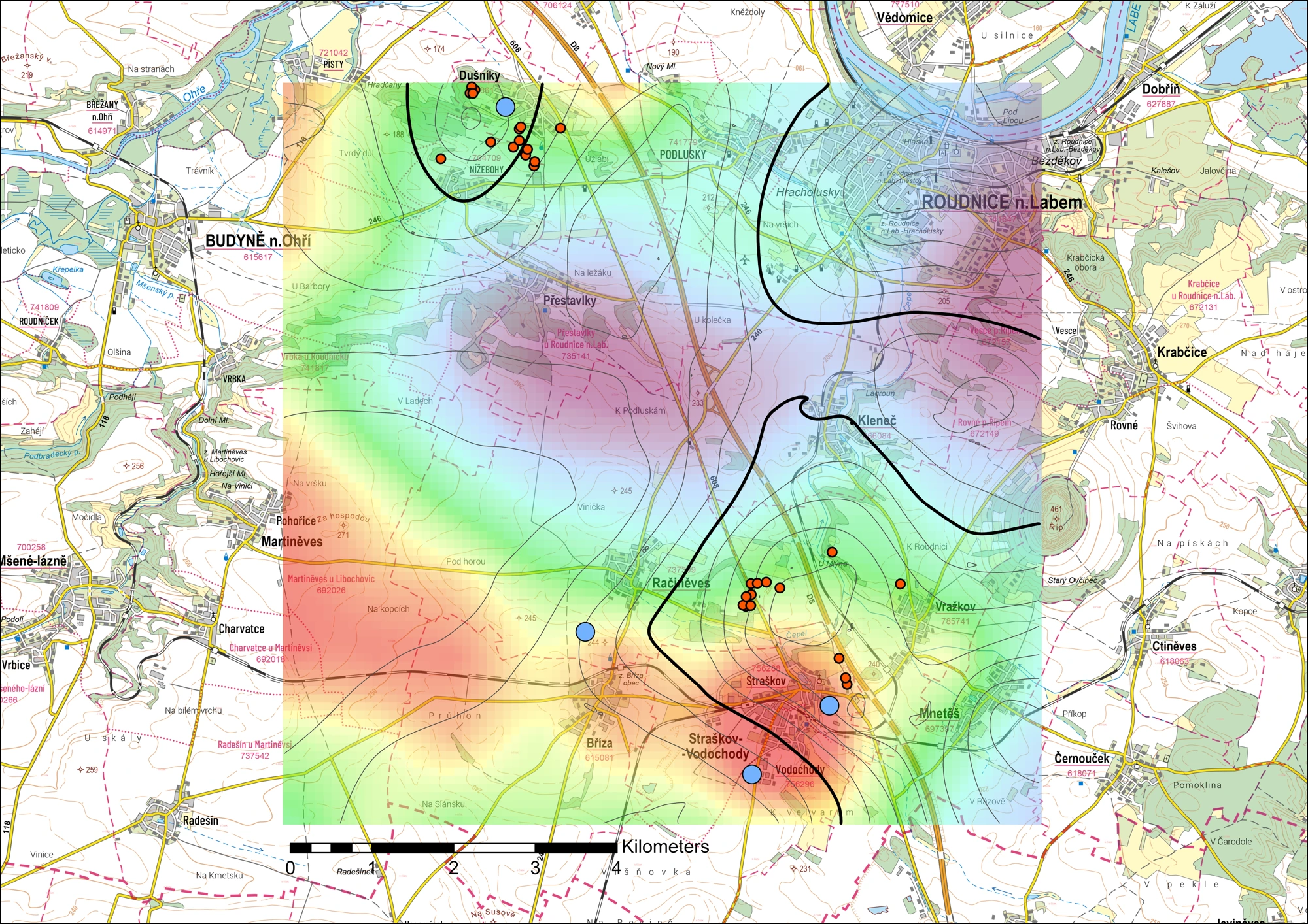
Approximate site locations, not grave or sampling coordinates. Base map © Esri.

GAČR · 25-15795K

GAČR–NCN Weave project 25-15795K investigates long-term changes in land use around prehistoric ritual places. Working with Petr Krištuf (University of West Bohemia) and Agnieszka Przybył (University of Wrocław), we connect archaeological research around Mount Říp and in Muszkowice with geochemical analyses at the landscape scale.

Team fieldwork
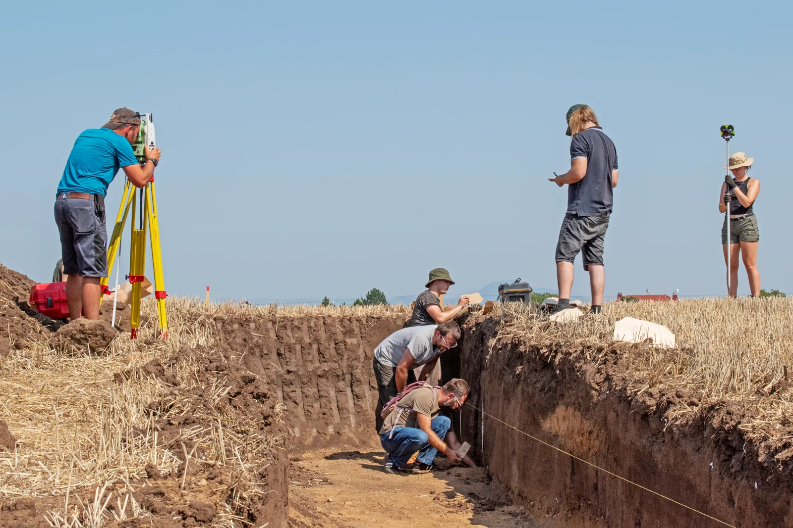
Team fieldwork

FAIR-CETA

Using two pilot geochemical datasets, we test and refine workflows for standardisation, FAIRification and long-term access to archaeo-environmental research data, making them understandable, discoverable and reusable. Outputs will include two FAIR datasets linking archaeological documentation with laboratory analytical data and a methodological research report. All outputs will be published through the ArcheoVault repository.
Výzva Minizáměry · Open Science II (OP JAK)

Research data processing

Sadová · five battlefield graves

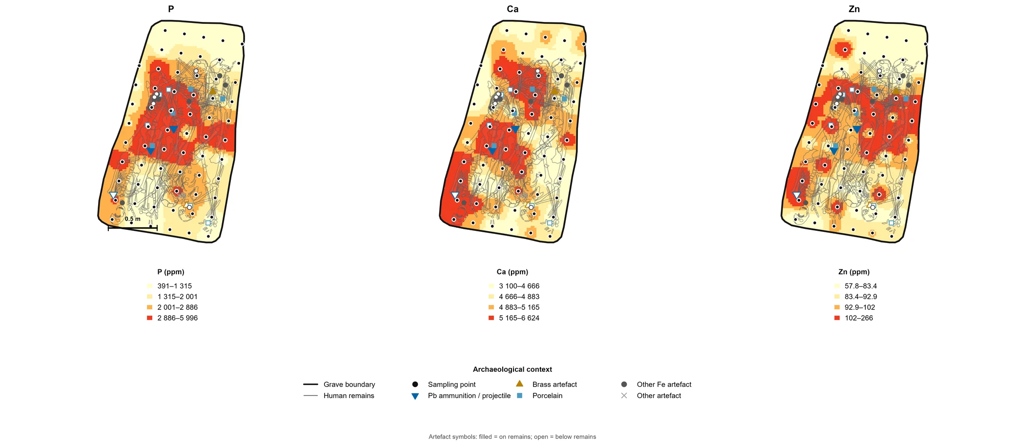
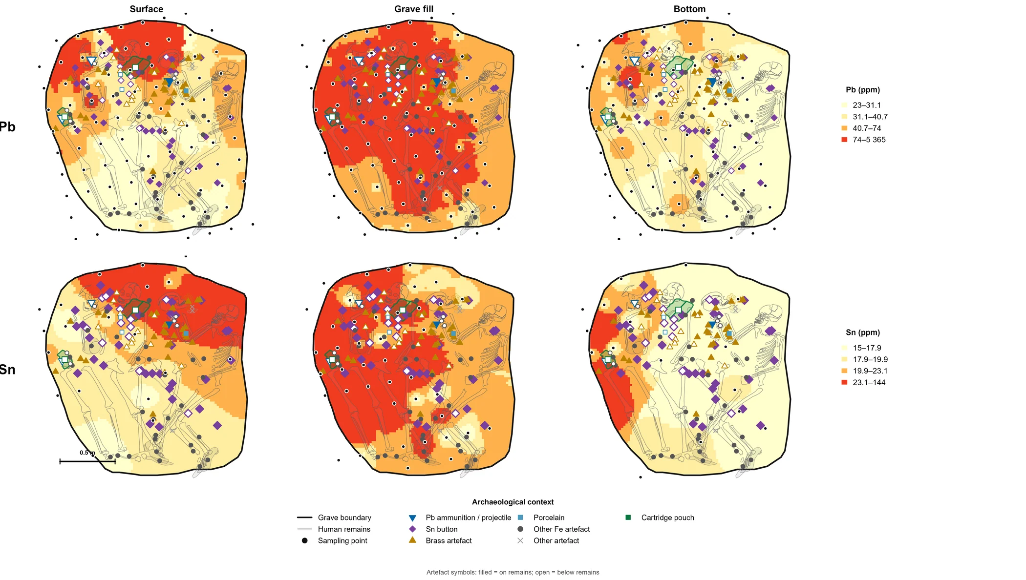
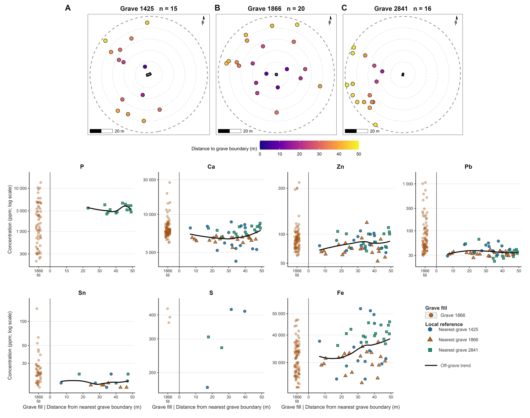
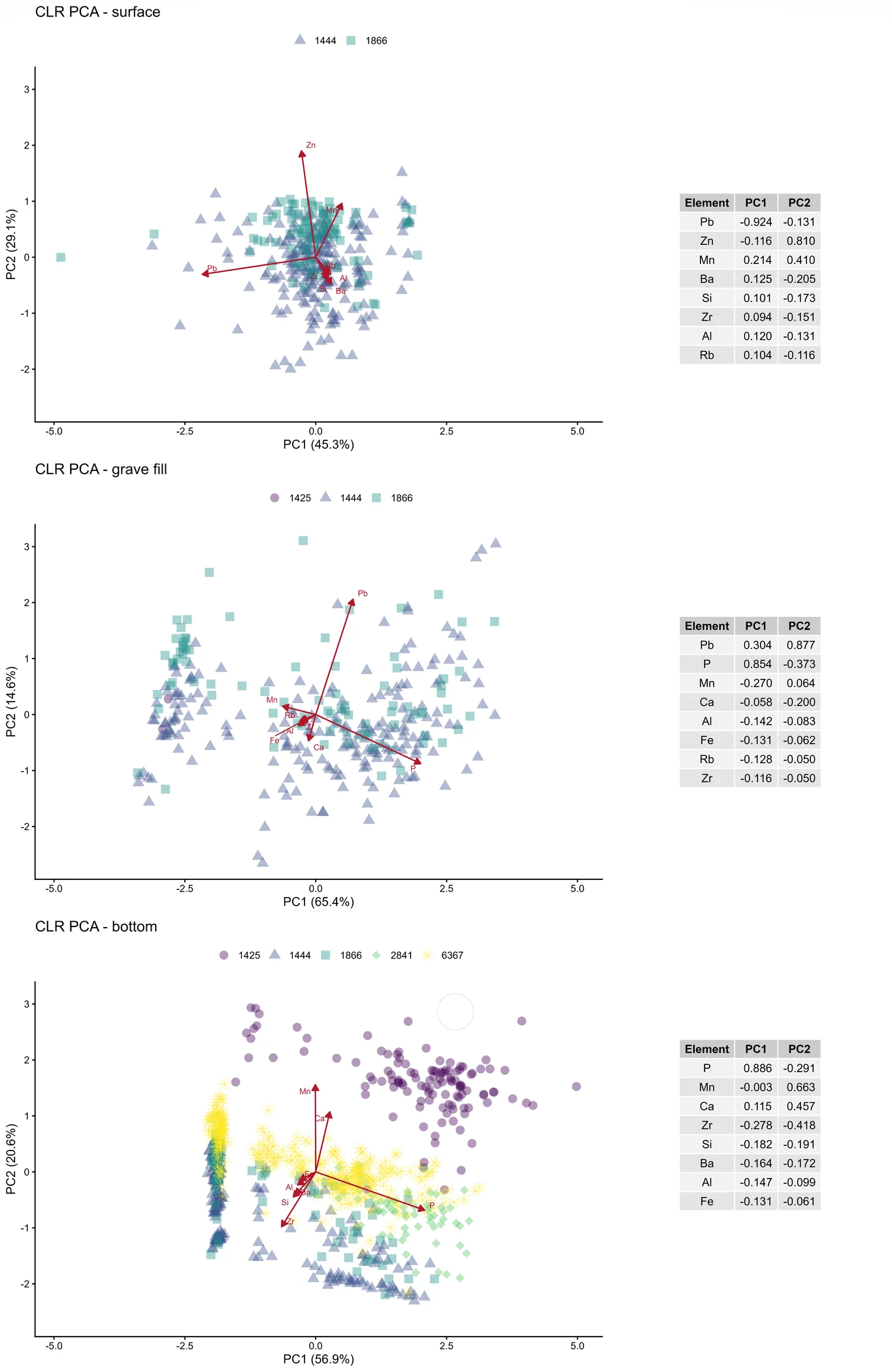
The dataset comprises 1,448 pXRF samples from five historical mass graves. Comparing geochemistry with grave locations and the soil background helps investigate which signals relate to burial and which to later land use.

Geochemical data · Sadová
Research details
1866 · soil geochemistry
Lead and tin in grave 1866
Spatial distribution at measurement points.
Phosphorus, calcium and zinc in grave 2841
Spatial differences in soil composition.
Grave and reference soil
Comparison of grave and surrounding-soil samples.
Geochemical structure of samples
CLR-PCA by archaeological sampling level.

Open Sadová data · ArchaeoVault ↗

The manuscript has not yet been published. Reuse of figures from the study requires author approval and compliance with publisher terms.

Říp · present-day soils and long-term land use

The RIP-ARCHAEOGEOCHEM dataset allows researchers to compare the distribution of elements in topsoil with archaeological sites and examine traces of long-term land use.

Geochemical map · Mount Říp region
Research details
1,291 topsoil samples

Open data · ArchaeoVault ↗

Muszkowice · a landscape of long barrows

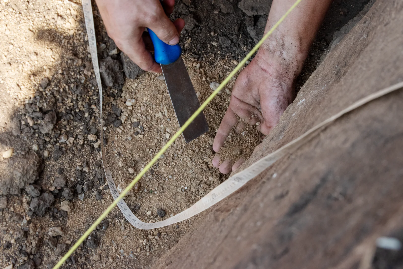
The forest near Muszkowice in Poland preserves prehistoric long barrows with stone perimeter structures. Together with nearby settlements and circular enclosures, they form a landscape in which we investigate differences in prehistoric land use through soil geochemistry.

Illustrative photograph · soil sampling

Písečný vrch · dating mining pits

At Písečný vrch, we combine airborne laser scanning, historical aerial photographs and field survey to examine traces of prehistoric and recent quartz mining. A MaxEnt model expresses each pit’s relative similarity to confirmed recent extraction features. It identified 293 candidates with higher archaeological potential for further verification, providing priorities rather than definitive dates.

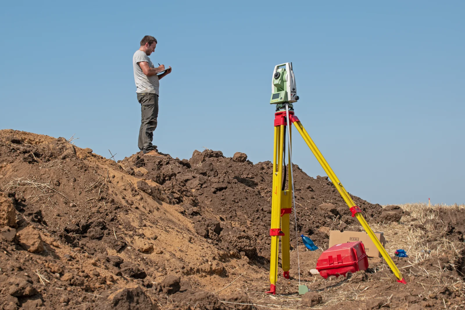
Illustrative photograph · field documentation
Research details

Combining laser scanning, historical imagery and survey supports non-invasive prioritisation of morphologically similar mining features. A cross-validated AUC of 0.691 indicates moderate discriminatory ability. An operational threshold of 0.441, selected through Youden Index optimisation, identified 293 pits less similar to confirmed recent mining. These results guide future archaeological verification and support heritage protection.

prehistoric mining

Publication · DOI ↗ · Data · ArchaeoVault ↗